Thursday, December 1, 2016

A Framework for the Design of Our Cities


Green.  Smart.  Sustainable.  Resilient.  
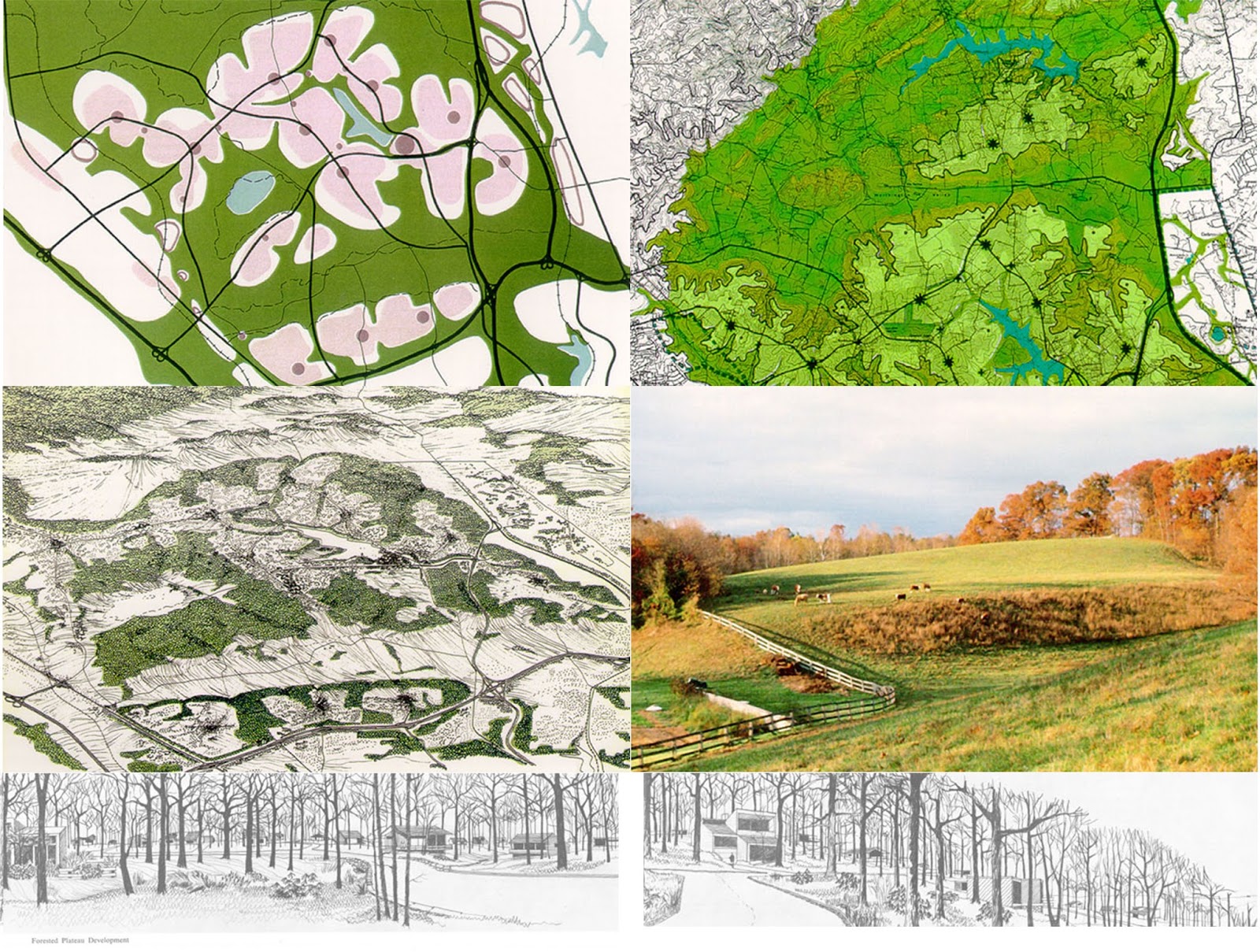
TOD.  TND.  New Urbanism.

These words and other similar en vogue phrases describe our current practices in Urban Design.  Each carry specific meanings, all of which overlap, all of which we struggle to remember the respective associated principles which define them.

What I want to focus on are the two words that describe the overall framework for which we strive to apply to the design of our cities:  Sustainable and Resilient.

Sustainability has been a concept that has had time to be accepted and thrown around at anything that seems somewhat desired and forward-thinking.  Simply stated in a report from the Intergovernmental Panel on Climate Change, "sustainable development seeks to meet the needs and aspirations of the present without compromising the ability to meet those of the future” (Brundtland, 1987, p. 39).

‘Resilient’ is a relatively new buzz word.  Resiliency speaks of a highly dynamic system that evolves through cycles of growth, accumulation, crisis and renewal.  Its aim is to recognize vulnerabilities in our communities in order to be able to prepare for, respond to and recover from impacts of our changing environment.

To compare the two, Zolli of The New York Times wrote, “Where sustainability aims to put the world back into balance, resilience looks for ways to manage in an imbalanced world” (2012).  He goes on to argue that the equilibrium that sustainability seeks to achieve is in fact unachievable.


Blackout in Lower Manhattan after Hurricane Sandy (picture from http://projourno.org/2013/01/sustainability-vs-resilience-dont-give-up-yet/).  The area was rebuilt after 9/11 to be sustainable with the largest collection of LEED-certified buildings in the world, but was not built to be resilient, as exemplified by a lack of redundant power systems (Zolli 2012).


Fleming has a similar response in his 2016 article in the Landscape Journal.  He argues that a shift is occurring away from the utopian ideal of sustainability and toward a more pragmatic concept of resilience.

Beginning in the late twentieth century, the cutting edge of ecological theory understood the natural world as a realm capable of a steady-state, utopian balance through the proper design, planning, and management of the environment. Put another way, the prevailing wisdom of ecology during the late twentieth century envisioned sustainability as both an admirable and attainable goal. Landscape architects and planners followed suit, but nearly a half-century into the pursuit of sustainability the planet’s CO2 emissions are still increasing, the planet’s development patterns are still sprawling into and consuming valuable and high-functioning landscapes, and the ecological crisis decried by McHarg and others still continues largely unabated (pp. 28-29).

These sentiments are understandable given the state of our cities, environment and even our economies.  Farr stated in his 2009 lecture, Sustainable Urbanism: Urban Design with Nature, that the American lifestyle currently inhabits 4 ½ ecological footprints, meaning it would take 4 ½ earths to sustain our current way of living. 

However, Farr is not one to argue against striving for sustainability.  In fact, while some feel it is imperative that a shift in thought from sustainability to resilience occur in the planning of our cities, others adamantly support the need for both—an essential relationship that compensates for flaws that may exist when locked in just one school of thought.  McPhearson at the New School in New York City opines that,

. . . [R]esilience needs to be linked to sustainability so that the resilience we are trying to plan and design for actually helps us move towards desired future sustainable systems states, and not undesirable ones. Current resilience planning and management efforts may just as likely be locking our urban systems into undesirable trajectories, away from sustainability (2014). 

Personally, I support this latter response.  I also believe strongly in one of the conclusions Farr came to in working toward sustainable cities: we need to realign our values and change our conduct as a society.  As designers, our power to stimulate change lies in our knowledge of how to create community—fostering aspects such as safety, attractiveness, social interactions, diversity, and efficiency.  What we need to strive for is to find ways to promote a restructuring of thought in regard to our lifestyles, whether that be through a lens of sustainability, resiliency or both. 


A resilient, sustainable solution for Miami-Dade County which faces a rising water table as sea levels rise.  The design replaces single family homes with increased density housing with rooftop gardens.  This allows for increased areas for open space which can be used for water storage.  The lower picture depicts housing in Amsterdam from which designers drew inspiration for their plan (McKay, 2014).


Brundtland, Gro Harlem. Report of the World Commission on Environment and Development: "Our Common Future." New York: United Nations, 1987. Print.


Farr, Douglas. "Sustainable Urbanism: Urban Design with Nature." Richard N. Campen Lecture in Architecture and Sculpture. Lecture.


Fleming, Ian.  “Lost in Translation: The Authorship and Argumentation of Resilience Theory.” Landscape Journal 35:1 (2016) 23-36.

McKay, Henry. "Climate Resiliency: Turning a Threat into an Asset in Suburban Miami-Dade County." Institute for Sustainable Communities Climate Resiliency Turning a Threat into an Asset in Suburban MiamiDade County Comments. N.p., 21 Aug. 2014. http://www.iscvt.org/climate-resiliency-turning-threat-asset-suburban-miami-dade-county/.


McPhearson, Timon. "The Rise of Resilience: Linking Resilience and Sustainability in City Planning." The Nature of Cities. N.p., 8 June 2014. http://www.thenatureofcities.com/2014/06/08/the-rise-of-resilience-linking-resilience-and-sustainability-in-city-planning/.


Zolli, Andrew. "Learning to Bounce Back." The New York Times. N.p., 2 Nov. 2012. http://www.nytimes.com/2012/11/03/opinion/forget-sustainability-its-about-resilience.html.

Thursday, November 10, 2016

Parameters of Success in Urban Design


A case study in New Urbanism

What are the measures of success in Urban Design? 

The players and factors come from all directions.  There are the obvious yardsticks which include: public areas that facilitate the interactions of people; designs that consider and accommodate ecological impact; facilities that embrace mixed socio-economic classes; atmospheres that feel safe and comfortable; spaces that are time, place and technology appropriate; and many others. 

These are all outcomes of a successfully planned urban space.  But the process of how we get there is as equally important as the goals we seek to accomplish.  The ‘how’ in the process of Urban Design is where UD and Development meet.  Planning for development (whether large-scale new development or miscellaneous plug-in objects of existing neighborhoods) and awareness of models for development that influence the process (specifically economic and political forces) are the first step in successful urban design.


Orenco Station

Orenco Station is a transit-oriented development (TOD) in Hillsboro, Oregon, a suburb of Portland.  Part of Portland’s 2040 regional plan, the fully planned mixed-use community located along the light rail has been considered one of “the most ambitious and most successful such communit[ies] to date” (Mehaffy, n.d.).


Hillsboro is a high-tech industrial area which created an abundance of jobs but lacked housing.  With the extension of the Westside MAX light rail, Portland’s regional government sought to fill the gap by designating sites as ‘Town Centers,’ which was the beginning of the greenfield site of Orenco as it exists today.


Architects, landscape architects, engineers and experts in retail and homebuilding were brought together by developers PacTrust and Costa Pacific Homes to work with local jurisdictions in the planning of Orenco Station.  During charrettes and consultation sessions, nationally-known planners and community design experts were invited and consulted.


In searching for models of success, the design team identified that a series of open spaces to link “the pedestrian experience through vistas and visual monuments, [to create] a stronger sense of place” (Mehaffy, n.d.) was a key aspect to their goal realization.
Furthermore, historical architecture was mimicked—but not copied—to establish emotional connection.


The next step involved the design team and City of Hillsboro planners creating an entirely new zoning ordinance.  Features of the new ordinance included 20’ “skinny” streets, close maximum street setbacks, accessory dwellings (“granny flats”), live/work homes, and alley-facing garages.  Within the town center, buildings are required to line the street with all parking in the rear.  The town center has been planned to the extent of retail options: the community’s uses and needs were accounted for to ensure that all services and entertainment exist to provide livability without the need for a vehicle.  The mixed-use urban center and high density housing that account for sense of privacy (about 18 units per acre) are additional key concepts to functionality of the town.

However, success is not overwhelming.  While it is theoretically possible to live in Orenco Station without a car, the train to Portland takes 40 minutes (not including walking and waiting time) and the surrounding area that provides still sought-after chain restaurants, fast food and strip malls are outside of walkable distance.  Also, despite attention to community needs in regard to retailers, few restaurants exist and shops are rather specialized.  Adding to potential downfalls, because of the quality of the neighborhood, the cost of housing is prohibitive.  And while open space exists, the question Kevin Lynch posed in 1972, How open are our open spaces? (Banerjee, 2001, p. 11) seems especially relevant.  The grand open spaces, carefully manicured shop fronts, and standard landscaped features purposely invite only certain behaviors and people to its public and public/private spaces.


Despite some arguable missteps, Orenco Station serves as a model for pedestrian-oriented TODs, both in planning and design.  Integrating mixed-use, open space and high density living into a desirable and economically viable town design, Orenco Station is overall an example of success.


This case represents just one typology of UD, and the most extreme.  More common are projects that do not seek to create entire communities.  In my opinion, total urban design, the creation of fully planned communities, inherently seems to feel exclusive and homogenized, despite efforts to synthesize diversity and inclusivity.  As Madanipour argues, there is a direct correlation between the size of a development and the size of the developing agency involved, and the larger-scale these two are, there is a tendency toward a standardization of design (1996, p. 138).  Reshaping existing communities and neighborhoods, or addressing functionality within urban spaces may better fit our growing population and its needs. 

Regardless, the restructuring of codes and regulations is the first step in designing successful spaces.  I believe that Orenco Station was successful in that aspect; not only was the town effective in carrying out a multi-step, multi-actor plan, but it challenged the status-quo of regulations in the area to prove viability of alternative visions of community.


Banerjee, Tridib. "The Future Of Public Space: Beyond Invented Streets And Reinvented Places". Journal of the American Planning Association 67.1 (2001): 9-24.
Madanipour, A. (1996). Design of urban space: An inquiry into a socio-spatial process. Chichester: Wiley.
Mehaffy, Michael. "UpSprawl Case Study." Terrain.org: A Journal of the Built Natural Environments. Terrain Publishing, n.d. http://www.terrain.org/unsprawl/10/ Accessed 8 Nov. 2016.


Tuesday, October 25, 2016

Representations of Space


Space is not an inert, neutral, and pre-existing given, but rather, an on-going production of spatial relations.


This concept, written as such in various publications and attributed to Henri Lefebvre, serves as a foundation for the analysis of the representation of space in urban design.  To define space as a relationship rather than a fixed area in time and space changes the way we may look at representations of conceived space.
 

Though this concept does not provide parameters for what urban design projects may look like, it does help to define the ultimate goal for such projects.  Representations of space are not merely pretty pictures drawn to attract support for a given project, but good representations tell a story that is much larger than a physical setting.

__________________________________________________________________________


Example 1:

Pioneer Courthouse Square in Portland, Oregon, had a long and interesting history throughout its transformations.  Situated in the downtown retail core of the city, the space that came to be known as “Portland’s living room,” was a result of active urban planning intervention to “fulfill cultural, recreational, open space and shelter needs for downtown populations” (Gragg, 2014).  To accomplish this, the Portland Development Commission held a competition in 1980, which was won by a team led by Will Martin.  His ideological framework was thus:


Let the space be ambiguous, fragmented and eternally changing, rich in local symbols and metaphor reflecting Portland’s history as well as bring meaning to citzens of all categories.  We hope to bring together many different meanings to be enjoyed and understood by varying tastes. . .hoping to stimulate discourse between different and often opposed taste groupings with meanings that add up and work together in the deepest combination.  (Will Martin diary, 1980, from Gragg, 2014)


https://aaa.uoregon.edu/100stories/alumni/willard-k-martin
(Gragg, 2014)
 The above drawings are from Martin’s diary with notes discussing his thoughts and process.  While these were personal references, I was attracted to the hand-drawn representations for the warmth and intimate feeling they emanate.  It brings visual storytelling back to its original form and its power cannot be overlooked.  While technology has enabled us to create lifelike representations of our concepts, the hand-drawn image provides meaning that is instantly relatable.

(Gragg, 2014)

This last image shows Martin’s design as he painted it upon the 40,000 square foot parking lot to further solidify public support—a rather creative and ingenious representation of the soon-to-be space.


Example 2:

The following is a block study by urban designer Jacob Dibble for a central neighborhood in Glasgow, Scotland, where a major motorway acted as a division through the community.  This was an academic project with the goal of reconnecting and reintegrating the urban form while keeping true to the historical urban fabric.


http://www.jacobdibble.com/?p=777

The first assessment compares block structure from the past, present and the proposed future.  The next diagram shows the structure form at present and for the proposed future.  The last diagram represents block size, comparing present and proposed block size as well as block size of a bordering neighborhood that functions well.


Together these representations serve to analyze the existing structure of the neighborhood while presenting a proposed solution.  The first two diagrams are easily understood and effective.  Without knowing the neighborhood, one can understand its past and present.  The diagram for the future correlates with the area’s history visually while adding modernity.  The third diagram was conceived mathematically and though visually appealing and indicative of much information, it is hard to understand on initial and second studies.  Dibble’s goal was to highlight the changes the proposed project would induce in the urban tissue.


Example 3:

The last example drew me in by the beauty of its images.  A graduate project by Shelley Long at the University of Toronto, her aim is to reimagine the national park system of Canada by way of the Trans-Canada Highway to include the human experience.  Her framework for analysis is Lefebvre’s “The Production of Space,” applied as follows:


The conceived space of designers delineates what is a city, park, or significant landform; the perceived space of imagination contains perceptions of pristine wilderness or idyllic agricultural settings; and the lived or experienced space of users operates at the scale and speed of the highway. These spaces are drawn respectively as layers of measured line drawings, postcards, and aerial/experiential imagery (Long, n.d.).


http://worldlandscapearchitect.com/wilderness-and-exodus-the-production-of-a-national-landscape/#.WA-wR4WcGUn

The representations take the viewer through the historical, natural, and human lived experience of the land.  The concept begins with a broad picture, continues with conceptual background, narrows down to specific sites for design, then returns to the larger area as a reinvented scheme.  The sheer scale of her design is further supported by the spaces left empty on the design sheets.  Conversely, the included snapshots of postcards work to bring the philosophical concept to a generally comprehensible scale.


It is unfortunate that the webpage format does not allow for full understanding because the images are undersized.  With that consideration, and perhaps regardless, the accompanying text (see site link) is necessary.  With a plan based on more abstract thinking, representations supported by description are crucial.

__________________________________________________________________________

These three examples demonstrate different aspects and methods of visual storytelling.  My goal was to explore a broad scope of samplings rather than comparable cases.  The commonality exists in that all exhibit space as a relationship: a historic, situated, pragmatic, evolving concept.  They identify transformations of the past and/or recognize that there are changes yet to come.  As differing as the above examples are, aspects of each help to paint a picture: from age-old pen and paper to scientific digital applications to representational modeling of the land and its metamorphosis.  Each conception creates understanding of a complex system of relationships—which is ultimately the goal of all representations of space in urban design.


If space is a product, our knowledge of it must be expected to reproduce and expound the process of production.  The ‘object’ of interest must be expected to shift from things in space to the actual production of space. . .Thus production process and product present themselves as two inseparable aspects, not as two separable ideas (Lefebvre, 1991).


"Block Study - Jacob Dibble Urban Design." Jacob Dibble Urban Design Block Study Comments. N.p., 2016. http://www.jacobdibble.com/?p=777  Web. 23 Oct. 2016.


Gragg, Randy, and Audrey Alverson. Pioneering the Square. Portland, OR: Portland Spaces, 2014. PDF.


Lefebvre, Henri. The Production of Space. Oxford, OX, UK: Blackwell, 1991. Print.


Long, Shelley. "Wilderness and Exodus: The Production of a National Landscape." World Landscape Architect. N.p., n.d. http://worldlandscapearchitect.com/wilderness-and-exodus-the-production-of-a-national-landscape/#.WA-wR4WcGUn Web. 24 Oct. 2016.


"School of Architecture and Allied Arts." Willard K. Martin. N.p., n.d. https://aaa.uoregon.edu/100stories/alumni/willard-k-martin Web. 23 Oct. 2016.


Tuesday, October 11, 2016

Design, Nature and Influence: Ian McHarg


Ian McHarg
In the introduction to Design with Nature, a book Ian McHarg self-described as his “most powerful identification” (McHarg, 1996, p. 206), Lewis Mumford succinctly sums up the philosophy of his friend and colleague:  “. . . McHarg’s emphasis is not on either design or nature by itself, but upon the preposition with, which implies human cooperation and biological partnership.” (McHarg, 1969, p. viii)

Ian McHarg was not a typical landscape architect, especially for his time.  He was an animated interdisciplinary thinker who was unconcerned about who he might offend.  His way of thinking was guided by a deeply felt connection to nature and an explicit mistrust in human motivations. 

Our failure is that of the Western World and lies in prevailing values.  Show me a man-oriented society in which it is believed that reality exists only because man can perceive it, that the cosmos is a structure erected to support man on its pinnacle, that man exclusively is divine and given dominion over all things, indeed that God is made in the image of man, and I will predict the nature of its cities and their landscapes.  I need not look far for we have seen them—the hot-dog stands, the neon shill, the ticky-tacky houses, dysgenic city and mined landscapes.  This is the image of the anthropomorphic, anthropocentric man; he seeks not unity with nature but conquest.  Yet unity he finally finds, but only when his arrogance and ignorance are stilled and he lies dead under the greensward.  We need this unity to survive (McHarg, 1969, p. 24).

Born in 1920 in Clydebank, Scotland, outside of the industrial city of Glasgow, McHarg grew up viewing the city during the depression era.  Though he describes his home of 18 years as one of “no distinction whatsoever” (McHarg, 1996, p. 14), he emphasizes the distinctive landscape: one which lies on the threshold between town and country.  The years of discovering the beauty of nature juxtaposed with the grimness of the city would influence the rest of his life, and consequently the design profession.

McHarg voluntarily joined the British Army in 1938 and after a distinguished 7-year career as a paratrooper in World War II, the resulting self-confident Major invited Harvard to admit him into the graduate program for Landscape Architecture—an invitation which was accepted.

Obtaining degrees in landscape architecture and city planning after 4 years at Harvard, McHarg returned to Scotland, but was drawn back to the United States in another 4 years.  It was at this time, in 1954, that he accepted a position as founder and chairman of the Department of Landscape Architecture and Regional Planning at the University of Pennsylvania’s Graduate School of Fine Arts.  Besides architects, landscape architects and city planners, the faculty McHarg brought into his department included a geologist, an ethnographer, an anthropologist, a medical anthropologist, a geochemist, a hydrologist, a soil scientist, a plant ecologist, a limnologist and a resource economist (Holden, 1977, pp. 379-380).  In addition to teaching, he also founded a private firm later known as Wallace McHarg Roberts & Todd (WMRT) which designed projects in both the United States and internationally.

WMRT plan for the Valleys (Greenspring & Worthington Valleys, MD), 1964, 
WMRT plan for the Woodlands, TX, located about 28 miles North of Houston.  McHarg was sought out for this project to protect the hydrological system and the woodlands, 1970, http://ladprofile.weebly.com/ian-mcharg-1920-2001.html


It is his book, Design with Nature, that brought him to the forefront of his profession and best describes for what he aspires.  His ecological based planning methods applied to design by superimposing layers of geographical data to reveal relationships which become apparent at spatial intersections to determine suitability for development.  His theories were based on the idea “that nature is a single interacting system and that changes to any part will affect the operation of the whole” (McHarg, 1969, p. 56).  Applying these methods, one can determine that “the lands that best preform work for man in a natural condition will not be those that are most suitable for urbanization. . . . (I)f one selects eight natural features, and ranks them in order of value to the operation of natural process, then that group reversed will constitute a gross order of suitability for urbanization.  These are: surface water, floodplains, marshes, aquifer recharge areas, aquifers, steep slopes, forests and woodlands, unforested land” (McHarg, 1969, p. 154).  While overlaid maps had been used by designers and planners before McHarg, he was the first to use ecology as the organizing structure.  Accordingly, McHarg’s planning methodology is credited with creating the intellectual framework for GIS technology and application (Steiner, 2008, p. 147).

© Ian McHarg, 1969, pp. 105-111.  Staten Island study

Till his death in 2001, McHarg pushed to increase the base of knowledge from which landscape architecture and urban planning drew.  He deplored design for design sake and the transformation of natural systems into artificial systems due to careless urbanization.  In part due to the innovative ideas of McHarg, the concept of designing with nature is no longer new; this is why Ian McHarg is among the most influential urban design thinkers.

“We are of nature, we live in nature.  The appropriate response is to understand its ways and behave accordingly” (McHarg, 1996, p.6).  


Holden, C. (1977). Ian McHarg: Champion for Design with Nature. Science, 195(4276), 379-382. Retrieved October 04, 2016, from http://www.jstor.org/stable/1743286.


McHarg, I. L. (1969). Design with nature. Garden City, NY: Published for the American Museum of Natural History the Natural History Press.

McHarg, I. L. (1996). A quest for life: An autobiography. New York: John Wiley & Sons.

Steiner, F. R. (2008). The Ghost of Ian McHarg. Log, 13(14), 147-151. Retrieved October 04, 2016, from http://www.jstor.org/stable/41765241.